
Example of uncropped areas:
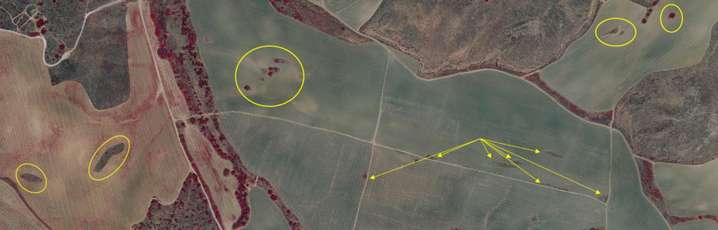
Despite the fact that they are statutorily defined as cultivated land, many areas in cultivated fields are not actually utilized for agriculture, or are only partially utilized. Such areas can be divided into two categories:
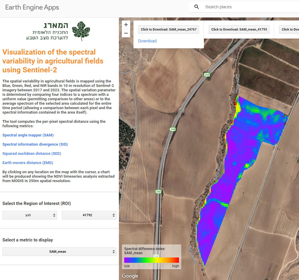
Hammarag, together with Israel’s Ministry of Agriculture and Rural Development, are interested in identifying and mapping such areas. To do this, Hammarag developed an easy-to-apply tool, based on remote-sensing, which analyses a time series of multi-channel satellite photographs, and maps each agricultural field. This tool has been automated and can now be used without human intervention, reviewing all of the statutory mapped agricultural plots which exist today in Israel – nearly 200,000 in number.
Example of uncropped areas: